
Rama Vihar Rohini Delhi is a developing residential locality in Block R of Rohini, North West Delhi — sitting near the Haryana border at the far western edge of the city’s planned expansion, connected to the Green Line metro at Mundka Station and awaiting the future Red Line extension that will bring the network significantly closer. PIN code 110081. The locality is positioned near Rohini’s Sector 38 zone, flanked by Kanjhawala Road to its south and open agricultural fields toward the Haryana boundary to its north — a setting that explains both the fresh air residents cite as a positive and the infrastructure gaps that characterise any fringe Delhi address still catching up to its master plan.
Residents rate Rama Vihar 3.8 out of 5 for connectivity and 3.5 for safety — honest scores for a locality where the metro requires a 6 km journey, the internal roads include unpaved stretches that become muddy in monsoon, and the distance to Kanjhawala feels lonely on night commutes. The counterpoint is real too: 3 BHK apartments and builder floors in a premium budget range, genuinely fresh air from open fields, and a Red Line metro extension confirmed for the future.
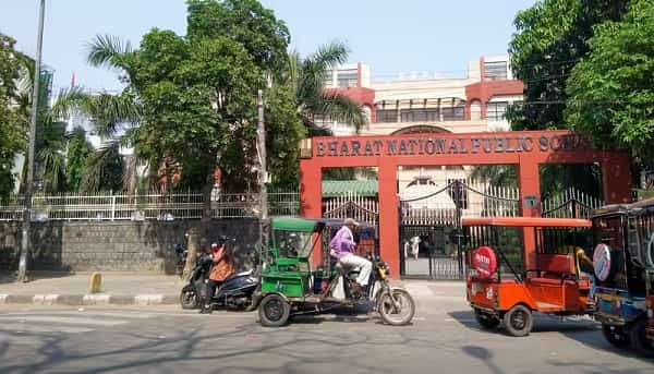
Rama Vihar Rohini Delhi Quick Overview
| Feature | Details |
| Location | Block R, Rohini (Haryana border zone), North West Delhi |
| PIN Code | 110081 |
| Nearest Metro | Mundka – Green Line (~6 km) |
| Future Metro | Red Line extension via Rohini Sector 37 Station (~4 km, awaiting approval) |
| Railway Station | Nangloi Railway Station |
| Key Roads | Manjari Road; 40 Feet Road; Kanjhawala Road |
| Airport Distance | IGI Airport – approx. 26–28 km |
| Property Type | 3 BHK apartments and builder floors (premium budget) |
| Employment Access | Netaji Subhash Place (~14 km); Mundka Industrial Area (~6 km) |
| Key Hospitals | Karala Government Hospital; Gahlot Hospital; Savitri Hospital |
| Future Infrastructure | Urban Extension Road 2 (UER-2) for enhanced airport and Gurgaon connectivity |
| Resident Rating | 3.8/5 connectivity; 3.5/5 safety |
Rama Vihar Rohini Connectivity – Green Line Metro, Future Red Line, and Road Network
Mundka metro station on the Green Line is the nearest metro access at approximately 6 km — a distance that requires road transport rather than walking, typically by auto or shared e-rickshaw to the station. From Mundka, the Green Line connects eastward through Paschim Vihar, Punjabi Bagh, Inderlok, and Netaji Subhash Place toward Central Delhi. Westward from Mundka, the extended Green Line runs toward Bahadurgarh in Haryana — a corridor that serves the Haryana commuter population and provides additional connectivity options for Rama Vihar residents who work in the Bahadurgarh industrial belt.
The more transformative metro development is pending: a Red Line extension toward Narela and Bawana via Rohini Sector 37 station — approximately 4 km from Rama Vihar — has been proposed and is part of Delhi Metro’s expansion planning. Rohini Sector 37 Station would be substantially closer than Mundka’s Green Line, and its Red Line connectivity would provide direct access to Rithala, Rohini East, Pitampura, and the full North Delhi spine. As of June 2026, this extension is part of the proposed Phase V(B) or expansion network but construction has not started.
Kanjhawala Road is the locality’s primary road spine — running east toward Rohini’s sector network and west toward Kanjhawala town and the Delhi-Haryana border. Manjari Road and the 40 Feet Road handle internal zone traffic. Nangloi Railway Station provides suburban rail access. Urban Extension Road 2 (UER-2) — the Delhi ring expressway project — will pass through or near the locality when complete, significantly improving connectivity toward IGI Airport (currently ~26 km) and Gurgaon. UER-2 completion would represent the road infrastructure equivalent of the Red Line metro extension — a structural connectivity improvement that transforms the locality’s daily commute geometry.
Rama Vihar Rohini Landmarks and Key Facilities
Rohini’s broader infrastructure extends to Rama Vihar’s accessible zone: the Centre of Excellence for Aquatics planned in Sector 33 Rohini (approximately 6 km) represents the kind of sports infrastructure investment that the RDA and Delhi government are channelling into Rohini’s outer sectors as development matures. Japanese Park at approximately 8 km extends cultural green access for residents willing to travel the distance on weekends.
Within the locality, the market infrastructure is basic but functional — a small market cluster serving daily grocery, pharmacy, and household needs. The Sector 38 area provides transport services cited by residents as the locality’s primary access point for DTC buses and shared autos. Begumpur Market at approximately 3 to 4 km extends shopping options for residents in the broader northwest zone.
The open fields on the Haryana boundary side are the locality’s most distinctive environmental feature — not a park, but genuinely open land that provides the air quality and sightline benefits that no urban park can replicate. Residents specifically describe the air as fresh due to these open fields, a characterisation consistent with Rama Vihar’s actual positioning at the edge of Delhi’s built-up fabric.
Schools, Healthcare, and Real Estate in Rama Vihar Rohini
Government schools near Kanjhawala Road and Sector 38 serve the locality’s school population. The broader Rohini school network — including Ryan International School, Titiksha Public School, and Happy Home Public School — is accessible from the outer sectors within a 5 to 8 km radius for families prioritising premium private school access.
Karala Government Hospital is the most directly cited government healthcare facility for the Rama Vihar zone. Gahlot Hospital and Savitri Hospital serve secondary and routine care needs. For multi-specialty and emergency care, the Rohini sector hospital network — including Saroj Super Speciality Hospital and ESIC Hospital — is accessible at approximately 8 to 10 km.
The property market at Rama Vihar offers 3 BHK apartments and builder floors in a premium budget range — specifically described as such in 99acres assessments, placing it above the purely affordable fringe category while remaining below the Rohini sector mainstream pricing. 20+ properties are available to buy. Water supply is via tanker and borewell rather than municipal pipeline in many blocks — a documented infrastructure gap that the RDA and Delhi Jal Board are expected to address as the zone’s residential density grows.
Environment – Open Fields, Infrastructure Development, and Air Quality
Rama Vihar’s most genuine environmental positive is what’s absent: heavy industrial activity within the immediate radius, dense traffic, and the hemmed-in air stagnation of more built-up Delhi localities. Open fields toward the Haryana border create air circulation and particulate dilution that residents notice as meaningfully fresher than central Rohini’s more built-out sectors.
The development-stage character brings predictable friction: unpaved roads in sections that turn to mud during monsoon, inadequate street lighting creating safety concerns at night, no direct bus to the metro station from within the colony, and water supply via tanker as the primary source. These are infrastructure gaps typical of a developing locality at Delhi’s outer edge — likely to improve as the area’s residential density builds, but present and documented right now.
Power supply reliability has been improving in the Rohini outer sectors. UER-2 road project and the Red Line metro extension, when completed, will be the defining infrastructure upgrades that shift Rama Vihar from fringe-developing to mid-segment established — a trajectory that comparable localities like Rohini Sector 22 and 24 followed in the decade after their first metro connection arrived.
FAQs About Rama Vihar Rohini Delhi
Q: Which metro station is closest to Rama Vihar Rohini?
A: Mundka station on the Green Line is approximately 6 km away — the current nearest metro. A future Red Line extension via Rohini Sector 37 station (approximately 4 km) is proposed and would be the closer and more practically useful metro connection, providing direct access to the Red Line’s North Delhi spine.
Q: What is the water supply situation in Rama Vihar?
A: Water supply in Rama Vihar relies primarily on tanker delivery and borewell sources rather than the municipal pipeline network. This is a documented infrastructure gap for the locality and represents one of the practical trade-offs of living at Delhi’s developing outer edge.
Q: What are property rates in Rama Vihar?
A: The locality offers 3 BHK apartments and builder floors in a premium budget range — above affordable fringe pricing but below mainstream Rohini sector rates. 20+ properties are available to buy. The developing infrastructure and metro distance keeps a price discount relative to inner Rohini sectors, while the eventual Red Line extension and UER-2 road project represent appreciation catalysts.
Q: What is UER-2 and how does it affect Rama Vihar?
A: Urban Extension Road 2 (UER-2) is a Delhi ring expressway project that will pass through or near the Rama Vihar zone when complete. It will significantly improve road access toward IGI Airport and Gurugram — reducing what is currently a 26 to 28 km journey to the airport into a faster, more direct route.
Q: Why do residents mention the air quality positively despite Delhi’s pollution?
A: Rama Vihar sits at the western edge of Delhi’s built-up zone adjacent to open agricultural fields toward the Haryana border. This open land context provides natural air circulation and particulate dilution that fringe localities enjoy compared to more landlocked central Delhi zones. Winter inversions still affect the area, but the baseline air quality outside those months is genuinely fresher than central Rohini’s more built-out sectors.